
Meet Latvian Geosite 2017 – Dzerkal Mountain
This year, as a result of a survey of the geologists of Latvia's annual geosites and a survey of natural experts, a mountain of Dzierkaļi (Dzierkaļi) was selected, located in Latgale, Rēzekne municipality, Kaunatas parish, Razna National Park. The name of the geosite of the year is allocated with the aim of paying public attention to the special geological formations of Latvia, to provide information regarding them, to encourage the identification and research of the site.
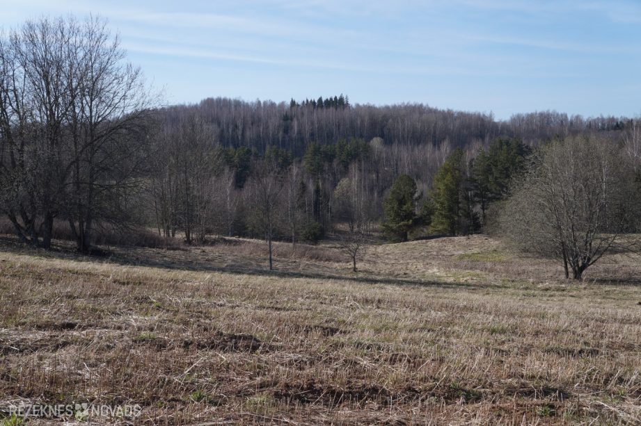
In Latvia, the Dzerkal Hill is special that it is excellent – a very high and steep terrain form. It is located in the upper part of Latgale, the hills of Raznava, approximately 700 m north-east of Great Liepukalna.
The mountain range is very high – 286.3 m above sea level – only 3 metres below the adjacent large Liepukalna – essentially its twin, but with several peaks and valves in the top of the summit. There is a version that the Dzerkal Hill might be the highest hill in Latvia by relative height (from step to top).
The land of the mountain hill has been used as meadows and pastures in the recent past, but it is now almost all covered with forest.
The name of the language of the language of the language of the linguists might be related to the name of the word poker/drunker/poker – a craftsman who kaļ the millstones. There are plenty of arable stones at the foot of the mountain.
The drunken hill is formed by the ice-time hose and its melting water has been activated 13-15 thousand years ago. The base of a large hill is made up of sand and gravel sediment precipitated in the strawberry cracks, as well as the moral clay. The location of the mountain in Latgale Hills Raznava hills is marked in the Latvian terrain map as a cover of the clay (so-called, zvonz), a dome-shaped hill (so-called, kema) or, in another version, a pre-array of pre-array. The setting of a year's geosite will help to find out what is the origin of the Dzerkal Hill and its surrounding hills and down.
As traditionally for the tenth year this is happening, an educational event will be organised in the geosite of the year with the participation of specialist geologists and an information stand on the Dzerkal Mountain will be placed at a suitable location.
The public event will take place on 13 May of that year, pl. 12:00.
In the program:
1. Gathering in a large Liepukalna park. Coordinates: x 726100; y 241740, or, in another version, E 27 ° 39,085 'N 56 ° 15,990' (see map for entry into link - http://balticmaps.eu/?lang=lv&draw_hash=qbhwqx¢erx=726046.0¢ery=6241774.0&zoom=3&layer=map&ls=o), follow the references to L. Liepukalna.
2. Discovery of the information star.
3. Hiking to the Dzerkal Mountain, approximately 1.5 km.
4. Specialist lectures and other information about the geology of the surroundings, landscape etc.; questions, discussions.
5. In conclusion, those who wish – the hiking of the geologist to the top of the Dzerkal Mountain and further, the Grand Liepukalna summit – with return to the beginning of the start-up assembly – approximately 2.5 km, along the forest and a barrier area; a medium to high level of difficulty.
The participants of the event shall have the clothing and footwear suitable for entering nature and weather conditions.
Estimated time of the event (p .1 to p .4) – 2 hours, hiking (p. 5) – 2 hours.
The Latvian National Geographical and Geology Division and Geology Museum, the University of Daugavpils, the Nature Protection Board, the Latvian Petroglifu Centre, the Municipality of Rezekne, THE Kaunatas parish administration.
All stakeholders are invited!
The information was prepared by:
Dainis oak,
association Norvidzeme Geopark