
On the survey of national geodetic network points
The Latvian Geospatial Information Agency (hereinafter - Agency) is a State administrative authority under the supervision of the Ministry of Defence which, in accordance with the functions and tasks specified in the Geospatial Information Law and Cabinet Regulation No. 384 of 9 July 2013, shall acquire, prepare and update the basic data of geospatial information, including maintaining a national geodetic network, which includes the survey of national geodetic network points in the area.
The request to inform the residents and entrepreneurs of the municipality that the employees of the Agency will perform the survey and sorting activities of the State geodetic network points in Latgale region, including the territory of Rezekne District, during the period from April to August 2020.
We wish to indicate that, in accordance with Section 9, Paragraph one of the Geospatial Information Law, the owner, lawful possessor or user of the immovable property shall not restrict the performance of geodetic and cartographic works in his or her owned or managed territory.
The staff of the Agency shall have a working certificate which may be presented as necessary. Travel is restricted to vehicles of national armed forces that can be recognized by national registration plate marks beginning with the letters LA. The staff of the Agency shall be dressed in working clothes bearing the identification marks - the logo of the Agency, the position to be taken and the name of the name.
The State geodetic network maintenance works shall be performed by a geodetic group in the composition of two persons who perform the following works:
- Perform geodetic point search in the area.
- Find a point center for a found bottom mark and take photos.
- Geodetic measurements shall be performed at the point.
- A burial (coupitus) shall be created for the bottom mark and the indicating stem shall be installed,
- Within a radius of five m from the centre of the point, a shrub and a tree of up to 12 cm in diameter shall be carried out.
- Take a photograph of the geodetic point and prepare a point abridge.
- The walls of the wall are cleaned from rust and other layers.
- An information plate is attached above the wall mark.
- Take a photograph of the geodetic point and prepare a point abridge.
Field tracking works may affect any location in the area of the municipality.
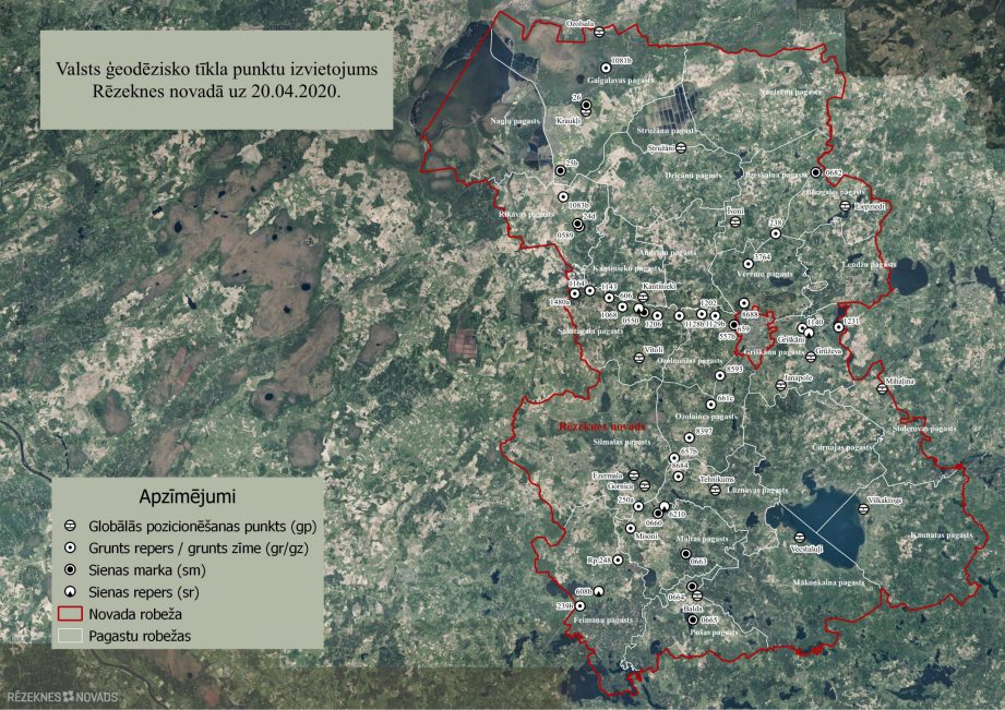
The list and scheme of the national geodetic network points in the territory of Rezekne shall be added to the Annex.
Information on the Agency can be found on websites www.lgia.gov.lv and http://map.lgia.gov.lv
Attachments:
1. List of national geodetic network points in Rezekne municipality.
2. National geodetic network point placement scheme in Rezekne municipality
Director of Latvian Geospatial Information Agency, Colonel Martin Liberts