
Griskanu civil parish


7677.8 ha
Pagasta kopējā platība
162.3 ha
ūdeņi
1625.4 ha
meži
4406.4 ha
l/s izmantojamā zeme
1811
Iedzīvotāju skaits (uz 01.01.2026)
Maximum sentence length exceeded.
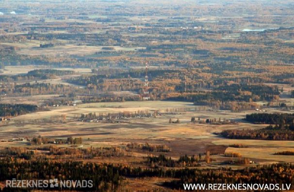
The north parish area borders Vērēmu parish and Lendžu parish, in the south-east with Stoļerovas parish, in the south with Čornajas parish, the west is a coproach with Ozolaines parish and the city of Rezekne. In the East, the parish borders the municipality of Ludza District, the border with the administrative boundary of Rezekne and Karsava. There are 45 villages in the parish, one of which is Spruce, Greykani , Janopole , Startup chips , Juvenovka, Chachi . The average population density is 25.5 people per 1 square kilometre.
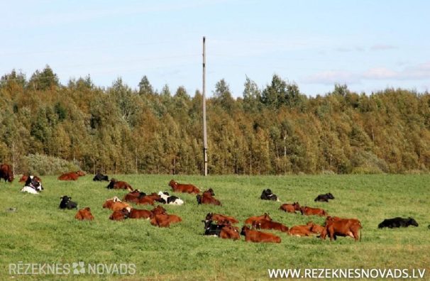
THE historic name OF Griškānu parish was Razna parish, the parish of Rozenmuiža. THE parish area of Griškānu has developed after World War II, it occupies part of the former Razna and former Makashan parish. In 1945, Razna parish created several villages, including Griškānu and Janopole village. In 1954, the village of Beauty was added TO THE village OF Griškānu, a part of the Janopolol village in 1963 and the rest of the village of Janopole in 1975. In 1963 and in 1981, a small proportion OF Griškānu village was included IN Lendžu village (now Lendžu parish). In 1990, Griškānu parish was established within THE village of Griškānu. THE largest part OF THE parish OF Griškānu is located at the height of Latgale Higher Rēzekne and only a quarter of the territory is submitted to Raznava hills. More than half of the parish area is agricultural land, agriculture, milk and meat production is also the main source of parish income.
In the 19 th century, the village of niperova was the Orthodox Church, nowadays there is no church in the parish area. The ievērojamais Catholic clerk, publicist, pedagogue and economic worker were active in the early 20.gs s. Angry Ranan, headed by the Greychen Agricultural School and the Latgale Agriculture Society, whose main objective was to promote the development of agricultural culture. In 1876, the magazine of makašānu (now Griškans) was born at Latgale awakening employee, the First Latgalian newspaper.Light ' publisher, journalist and poet Francis Kemps.

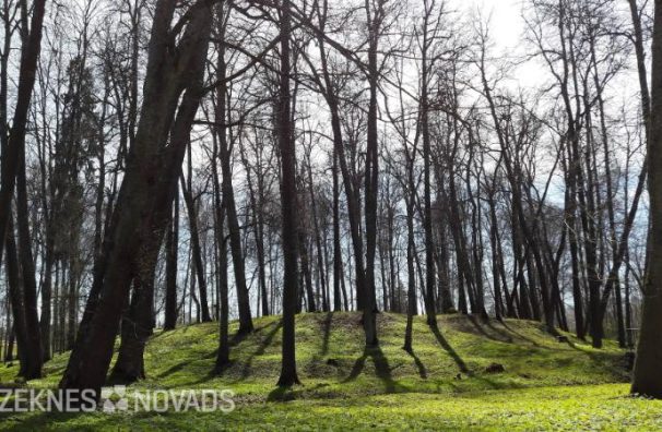
From 1811 until 1939 he lived in the Polish-born Roman family. The creative activity of Antonia Kazimir Romera (1889-1973), wife of Anna Soltan-R ӧ Mer, 1895-1974, who was known as an artist both in Latvia and across Europe, was particularly important. There was an ancient and extensive collection of ceramics in the estate. The Cathedral of the Catholic Cathedral of the Catholic Catholic Catholic of Rezekne was built from the burnt bricks of Romera, and each of them had a “firm mark” - initials KR (Kazimir Romers). From the ancient Romera manor, the Park Park has been preserved, which is now cleaned and well-equipped.

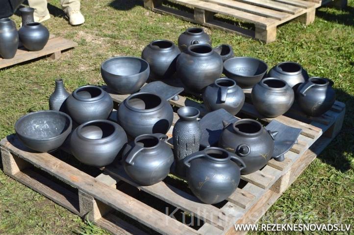
Griškana parish can be proud of famous Latgale ceramics Juri Crompon, Anatolia Vituskin, Viktor and Andri Ushpeal. In 1975, his ceramic workshop, continuing in the fourth generation of the family tradition, was built by Peter Ushmis (1950-2003), but he was soon joined by his younger brother Victor. Masters' performance as well as People's applied art studios "Rēzekne county puzzles' driving, saving and developing traditions is assessed by a three-star order. Now this is his son. Andris Ushmis. Ceramic workshops and biscuits are open to visitors to let anyone know the miracle of clay dishes.
More than half of the parish area is agricultural land, agriculture, milk and meat production is also the main source of parish income. One of the largest agricultural enterprises in Rezekne, SIA, operates in this sector. Spruce M (manager Pavel melnis), who manages large areas of land in the municipality of Griškana, produces cereals, produces milk and meat, provides agricultural technical services to the population. With the funding of European Union funds, SIA Spruce a new, modern grain of grain has been built, bought a powerful agricultural technique.
- Successful farm farms Gilts, bells, raikes.
- The Jianopole village operates a company Rezekne Field Technique, SIA Vector.
- Juvenovka village operates companies providing various types of services: freight transport (SIA Mechanisation), heating boilers, sewerage and sewerage repair works (SIA Santek) Wholesale of construction materials and farm goods (SIA DAKO), dealing with wood processing (SIA AVIN, SIA DAKO), Import and Wholesale of Fuel (SIA AVIN), trade in parts and accessories of motor vehicles and agricultural machinery (SIA Hydraulic), repair, purchase and sale of electric and domestic electrical pumps (SIA Energy), repair and maintenance of cars (SIA Autocolor).
- Starchikiki Lojaskalns - hotel house, accommodation
- Medical aid to parish is provided by the Griškana and Yanopole feldshers and midwives.
- Horse stallis HEVO - horse stallion. On the holding, the surface area with the sand cover is established. I used tyres and birch cards instead.