Viewing objects and historical persons
Nagļu parish is tourism information point, which is set up at farm "Zvejnieki" Local gide offers excursions to stakeholders through the unique ecosystem of this area and presents cultural and historical heritage and fisheries Nagļi. It can be fished, swimming, watching birds, doing sports, sitting, berming, enjoying sauna magic. The beauty of the swamp will be met by 800 m-long kindles In Teirumnik swamp.
Archaeological evidence
Since 1962 archaeologists Ilze Loze a systematic archaeological study of Lubana plains was launched under management. The archaeological material obtained mainly covers time from mezzolite to mid-bronze. These studies show that Luban's land in the stone age has been one of the most densely populated areas in Eastern Baltic. There has also been live trade with other landings, according to the flint and Dzintars coming from the distant. The Aiviekstes waterway was the most important for the maintenance of the exchange communications. IN THE parish area OF Nagļu, 7 ancient settlements and 3 ancient capuaries are located. The Full Scale of Iceland, with a great view of Lake Luban and surrounding clan, is an archaeological monument of national significance. A number of protected archaeological monuments of national significance are located in Nagļu parish: Īdeņas Hill and ancient grave, Lazdavnieki ancient grave, Sūļagala camp and Zvejsalu camp, the archaeological monument of local significance Ašu sila camp.
Icelandic castle and ancient grave
The ancient funnel is shown to have a grey cultural layer of colourless, smooth and ripe ceramic clay fragments.
As they arrive at the edge of the hill, the slopes of the trees grow down, and forward, across the trees and bushes, the plains of Luban.
It says that gold money has been stored in the castle and is “sanctioned by soldiers in war times”
.
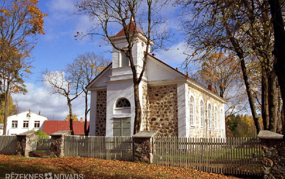
Nagļu Sv. John Christian Roman Catholic Church
 Nagļu Iu. In 1862, the Catholic Church of John's Christian Roman Catholic Church was appointed by Mr Nabel. Nagļi was originally a Viļānu branch church and was served BY Viļānu Bernargod monks. After the closure of the monastery, the 19 th century. In the 30 th years as Viļānus, its Nagļus served the early priests.
.
.
.
Luban Fish Pond
 The largest complex of fisheries ponds, established in the 20 th century with the creation of Lubana Hydrotechnical System. The fish ponds are located on the Luban Palace peat. The large part of the ponds from all sides is restricted by dams.
As Luban's fish ponds are one of the richest and most diverse leisure sites of waterbirds and migratory birds, there are extensive bird-opening possibilities in the App, also from specially built bird-watching towers.
.
Teirumnīku swamp trail
An 800 m long trail formed between Lubanu and Orente ponds, surrounded by a high-pitched landscape, Teirumnik lakes and marshes. The trail leads to a long stretch of Teirumnik lake, where there are resting places. The trail of the swamp is not local – that means that you can return to the starting point of the journey by walking back down the courtesy or through the forest road that throws the circle along the edge of the swamp.